News
UN Votes to ‘Correct the Map’ and Show Africa at Its True Size

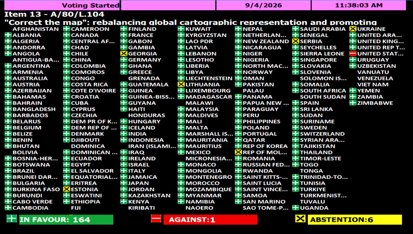
NEW YORK, September 4, 2026 — The United Nations General Assembly has backed an African-led campaign to change how the world is represented on maps, approving a resolution calling for greater use of map projections that more accurately reflect the true size of continents, particularly Africa.
The resolution, “Correct the Map: Rebalancing Global Cartographic Representation and Promoting Equitable Representation of the World’s Regions, Particularly Africa,” was sponsored by Togo on behalf of the African Group.
It passed by an overwhelming 164 votes to one, with six countries abstaining. The United States was the only country to vote against the resolution.
The vote represents a diplomatic victory for the African Union, which endorsed the Correct the Map of Africa initiative earlier this year and tasked Togo with taking the campaign to the United Nations.
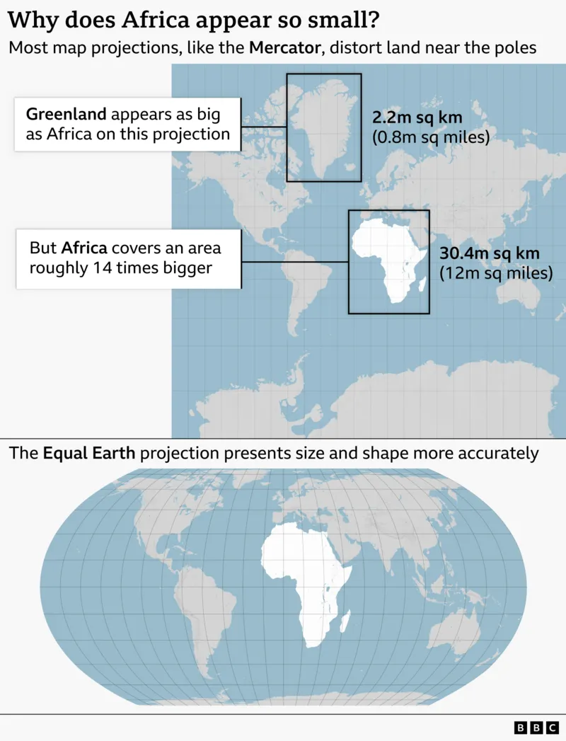
At the centre of the campaign is the Mercator projection, developed by Flemish cartographer Gerardus Mercator in 1569. Although the projection remains highly useful for navigation, it dramatically enlarges land masses as they approach the North and South Poles.

The result is a world map in which Greenland appears roughly comparable in size to Africa, despite Africa being approximately 14 times larger.
The African campaign promotes alternatives such as the Equal Earth projection, developed in 2018 to preserve the relative area of continents more accurately.
The African Union endorsed the Equal Earth projection in February 2026, arguing that it provides a more faithful representation of Africa’s geographic scale.
‘A Fair World Begins With a Fair Map’
Togo’s Foreign Minister Robert Dussey, who has spearheaded the diplomatic campaign, framed the issue as one of representation rather than merely cartography.
“A fair world begins with a fair map,”
Dussey told Reuters ahead of the vote.
In a briefing to the African Group ahead of the General Assembly vote, Dussey described the initiative as part of a broader African effort to advance the continent’s interests and challenge longstanding perceptions about Africa’s place in the international system.
The Togolese government argues that maps influence how people understand geography, relative importance and global power.
That gives the campaign a distinctly geopolitical dimension.
For African policymakers and advocates, correcting the visual distortion is also about correcting a narrative in which Africa can appear geographically smaller — and, by implication, less significant — than it actually is.
More Than a Map
The resolution does not amount to a legal prohibition on the Mercator projection.
The Togolese government has stressed that the resolution does not challenge the continued use of Mercator for maritime and aerial navigation, where the projection remains particularly useful.
Instead, the resolution encourages international institutions and other users of world maps to adopt projections that provide a more accurate representation of the relative size of countries and continents.
The UN action therefore has greater symbolic and political significance than regulatory force.
It comes amid broader African efforts to reshape international narratives and institutions, from demands for reform of global governance structures to campaigns addressing historical injustices and Africa’s representation in international decision-making.
The African Union’s endorsement of Correct the Map described the initiative as part of an effort to address longstanding distortions of the continent’s size and global significance.
A Rare US Dissent
The United States’ decision to vote against the resolution also adds a diplomatic dimension to the outcome.
With 164 countries voting in favour, including major European powers such as France and the United Kingdom, Washington stood alone in opposing the measure, according to reporting on the vote.
The US argued that the initiative promoted an ideological agenda and distracted from what it described as more pressing international challenges.
For Africa, however, the vote demonstrates the extent to which the continent can mobilise broad international support around questions of representation and global equity.

The resolution is non-binding, but its adoption could influence the maps used by international organisations, educational institutions and other bodies around the world.
The message from Africa’s campaign is ultimately straightforward: before the world debates Africa’s place in the global order, it should at least see the continent at its true size.
“Correct the map” may be about geography — but the argument behind it is about power, perception and Africa’s place in the world.
Source note: The UN’s official daily document list identifies draft resolution A/80/L.104 as the “Correct the Map” resolution considered by the General Assembly.